Properties Panel (R3PROPERTIES)
Command: R3PROPERTIES
Opens the R3Properties panel. Click on any line, arc, polyline, or Survey Plan component to instantly display its survey properties — bearings, distances, arc details, and areas — in the configured display units. Also displays survey plan metadata.
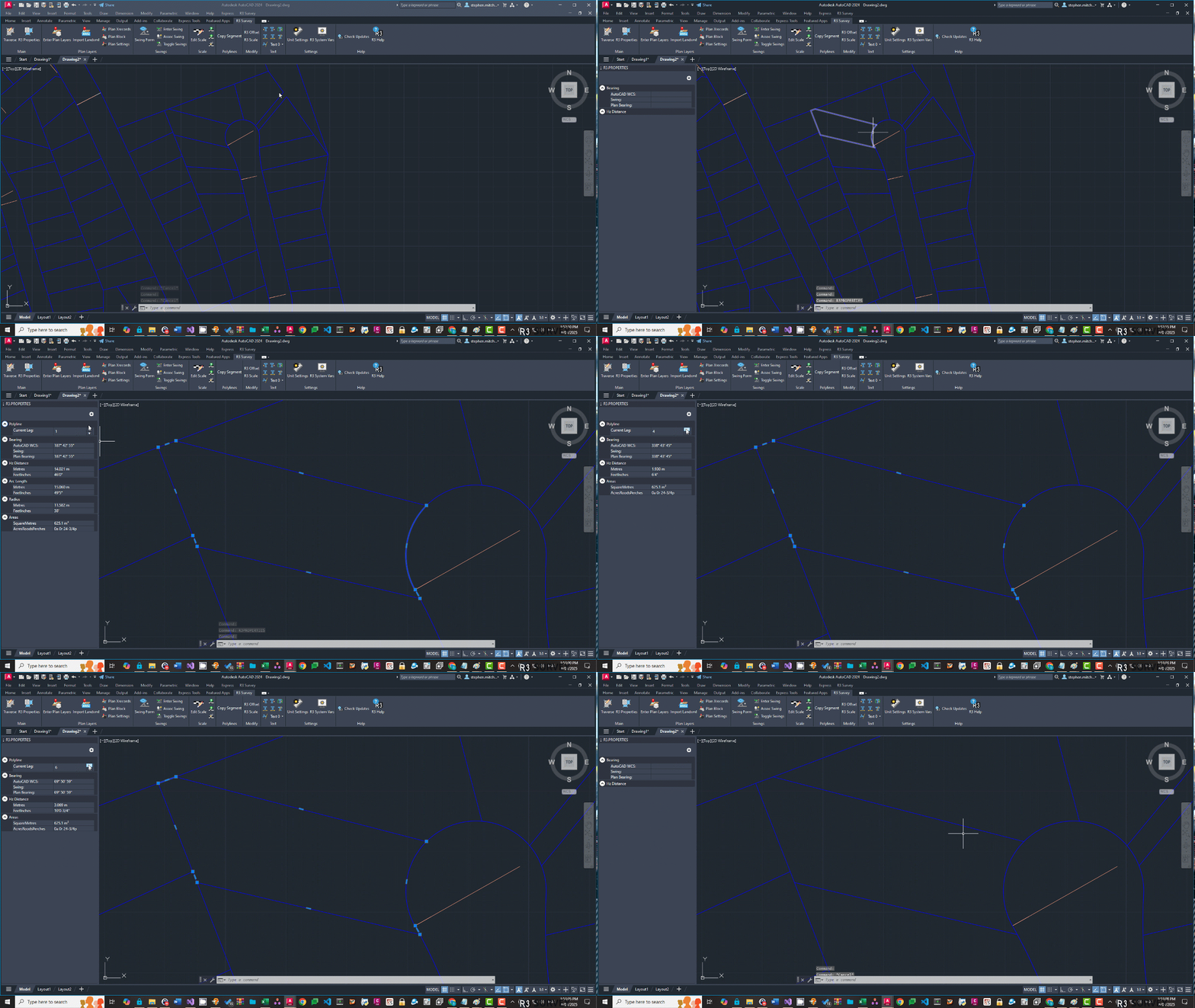
Opening the panel
Type R3PROPERTIES at the command line or click Properties in the R3Survey ribbon. The panel opens as a dockable palette and stays open while you work.
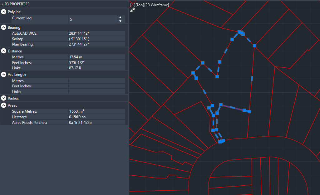
Supported entities
Lines, arcs, and polylines (LWPOLYLINE). The panel updates live as you click different entities.
What is displayed
Lines and polyline segments
| Property | Description |
|---|---|
| Bearing | WCS bearing from start to end, in current angle format |
| Distance | Horizontal distance in current length units (not the 3D length) |
Swing display
If swings are enabled, three bearing rows are shown: the WCS bearing (raw drawing angle), the swing value, and the corrected plan bearing (WCS minus swing).
Arcs
| Property | Description |
|---|---|
| Chord bearing | Bearing of the chord from start to end |
| Chord length | Straight-line distance from start to end |
| Arc length | Distance along the curve |
| Radius | Radius of the arc |
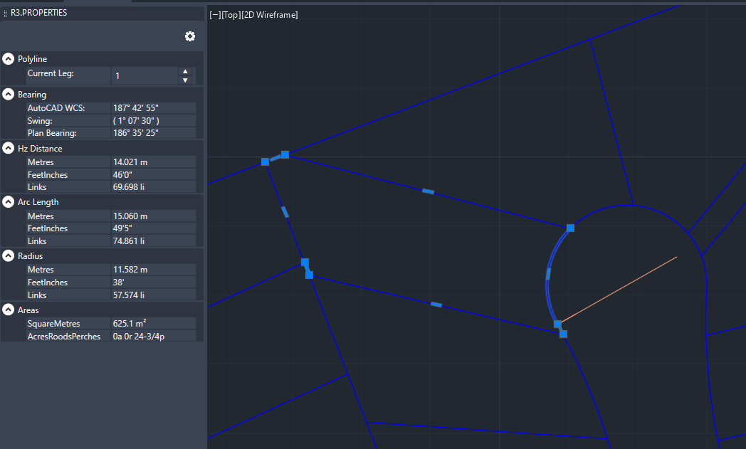
Polyline navigation
When a polyline is selected, a Current Leg selector lets you step through individual segments without clicking each one in the drawing:
- Select a segment using the leg selector and the properties update immediately
- The active segment is highlighted in the drawing
- Click near a specific segment when first selecting a polyline to open it with that leg active
Closed polylines and parcels
| Property | Description |
|---|---|
| Area | Area in up to three display units simultaneously |
| Perimeter | Total perimeter length |
Area calculation assumes polylines are closed (or have a small misclose within tolerance) and do not self-intersect. If a self-intersecting polyline is detected, a warning is shown.
Survey plan data
When entities on survey plan layers are selected, additional expanders appear below the geometry properties. Which expanders are shown depends on the entity type and layer.
Dimension Overrides expander
Visible when a line or polyline on a survey plan layer is selected. Editable fields for legal dimension overrides used in NSW LandXML export.
For polylines, use the Current Leg selector to navigate between segments — each segment stores its overrides independently.
| Field | Description |
|---|---|
| Bearing (D.MMSS) | Legal bearing (overrides computed bearing) |
| Hz Distance (m) | Legal horizontal distance (overrides computed distance) |
| Arc Length | Legal arc length (arc segments only) |
| Radius | Legal radius (arc segments only) |
| Dim. Suffix | Free text appended after the distance on the plan |
Survey Leg Properties expander
Visible when a line or polyline on a survey plan layer is selected. Controls the observation type. Collapsed by default — most lines are "Measured" with "Linear Boundary" and don't need changing.
| Field | Description |
|---|---|
| Method | The observation method — Measured, Compiled, or a GNSS method. Default: Measured for surveyed plans, Compiled for compiled plans. |
| Boundary | The boundary type — Linear Boundary or Natural Boundary. Default: Linear Boundary. |
See Observation Overrides for the full workflow.
Reference Mark expander
Visible when a line on a Reference Marks layer is selected, or when the entity has RM XData. All fields are editable.
| Field | Description |
|---|---|
| Type | Monument type (DH&W, GIP, Peg, PM, Nail, etc.) |
| State | Monument state (Found, Gone, Not Found, Placed, Not Marked, Found By Me) |
| Origin | Origin survey plan number |
| Desc | Monument description |
| Line State | State of the reference line — Found, Placed, or Found By Me. Maps to distanceAccClass in LandXML. |
SCIMS Control Point expander
Visible when an R3_PM_A block on the plan's Control Marks layer is selected (imported by R3IMPORTSCIMS or inserted manually with R3PM). Most fields are editable.
| Field | Description |
|---|---|
| Mark / Number / Desc | Mark identification |
| Status | Mark status from SCIMS |
| Zone / Easting / Northing | MGA coordinates |
| GDA Class / PU / LU | Horizontal accuracy |
| CSF | Combined scale factor |
| AHD / AHD Class / AHD PU / AHD LU | Vertical data |
| Datum | Datum terminal designation — set to X (Terminal A) or Y (Terminal B) for NSW LandXML export |
Parcel expander
Visible when a polyline on a survey plan layer is selected. Editable fields for parcel attributes used in LandXML export.
| Field | Description |
|---|---|
| Lot | Lot number. Prefix with PT for part lots (e.g. PT 51) — the prefix is stripped and ParcelType is automatically set to Part. |
| Sec | Section number. Only visible when populated (typically from imported LandXML files). |
| Plan | Plan number (for adjoining lots, e.g. DP123456). Only visible when populated. |
| Description | Context-specific label depending on class — Road Name, Easement Desc, Water Body, etc. Only visible for classes that need it. |
| Class | Parcel class — Lot, Road, Easement, Hydrography, etc. Auto-populated from layer component type. |
| State | proposed, existing, or adjoining |
| Type | Single (default) or Part. Part lots with the same lot number are grouped as a multipart parcel on export. See Lot Numbering. |
| Format | Standard or Stratum |
See Preparing a Survey Plan for detailed guidance on setting parcel attributes.
Display units
You can display up to three length units and up to three area units simultaneously. Click the gear (⚙) icon at the top of the panel to configure which units are shown.

In the settings dialog:
- Length Units tab — select from available length units and add to the display list
- Area Units tab — select from available area units
Use the up/down arrows to reorder units. Custom units must first be defined in R3UNITS before they appear here.
Bearings are displayed in the angle format (North Azimuths, Surveyor's Bearings, or Gradians) and display style (Compact, Spaced, or Decimal) configured in R3UNITS.
See also
- Units — explanation of length, area, and angle units
- R3UNITS — configuring display units, precision, and formats
- Swings — how swings affect bearing display
- Observation Overrides — setting legal dimension overrides for NSW export
- NSW Digital Plans — end-to-end ePlan workflow
Notes
- The panel is modeless — it remains open and updates as you click different entities
- Distances shown are horizontal distances, not 3D lengths
- Display precision and formatting come from R3UNITS settings
- Swing display, parcel and easement properties require a valid R3Survey licence